
How Accurate Is an iPhone LiDAR Floor Plan? (And How to Trust It)
By Salar Kiabi, Founder, FIMIT · · 6 min read
Last reviewed
In good conditions, iPhone LiDAR floor plans are usually accurate to within a few centimetres — good enough for real-estate floor areas, as-built drawings, space planning and maintenance scoping. But iPhone LiDAR accuracy is not a single fixed number, and treating it like one is how people get burned: the real figure shifts with the device, the room size, the surfaces and how carefully the space was captured. Before you rely on a dimension for anything contractual, structural or safety-critical, validate it against a tape or laser. The honest, more useful answer is that accuracy depends on the capture, and the tools that deserve your trust are the ones that tell you how accurate a given scan actually is — rather than handing you a figure and hoping you believe it. This article breaks down where the accuracy comes from, what changes it, and how calibration turns a good-enough number into one you can defend.
What "accurate to a few centimetres" really means
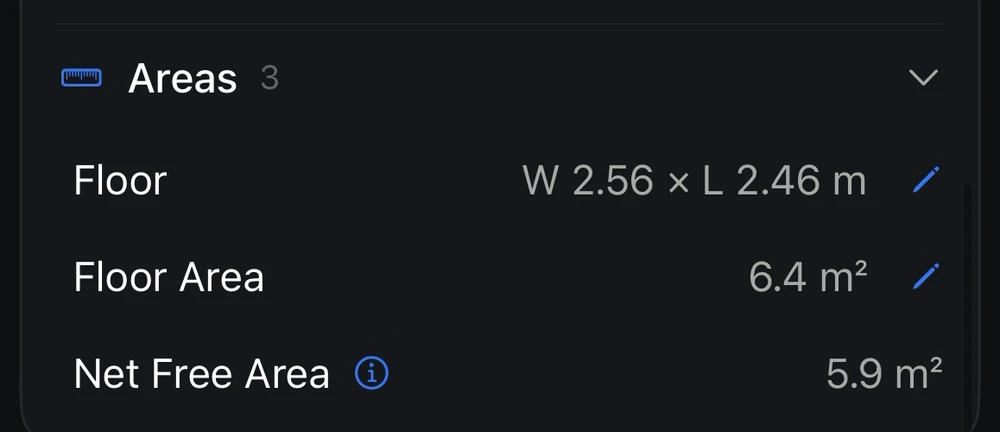
A LiDAR-equipped iPhone or iPad Pro builds the geometry of a space from millions of depth samples as you walk through it. Under good conditions the resulting measurements often land within a few centimetres of the truth — sometimes better, sometimes worse, depending on the device, the room and the capture. Any single headline figure actually hides two very different kinds of error, and understanding the split is the key to understanding iPhone LiDAR accuracy:
- Bias — a consistent, systematic offset, for example every length reading a steady one percent long. Bias is the good kind of error, because if you can measure it you can correct it away.
- Noise — random scatter from run to run, the physical noise floor of the sensor. Noise cannot be corrected out; it is the hard limit on how precise the instrument can be.
This matters because a tool that quietly corrects bias but hides noise is flattering itself. The trustworthy approach is to report both: how far off the scan tends to be, and how much irreducible scatter remains underneath. When you know the bias, you can subtract it; when you know the noise floor, you know how much run-to-run variation to expect and can decide whether the scan is precise enough for the decision in front of you. A number without that context is just a hopeful guess dressed up as a measurement.
What affects the accuracy of an iPhone LiDAR scan
Two identical phones can produce noticeably different results depending on how, and where, they were used. These are the factors that move the needle most:
- Coverage: walking the full perimeter and catching every corner beats a rushed pass that leaves the geometry to be guessed.
- Distance and room size: very large rooms and long unbroken spans accumulate more drift than compact, well-defined spaces.
- Surfaces and lighting: glass, mirrors and very dark or shiny surfaces are genuinely hard for LiDAR, and tagging them helps the software handle them correctly.
- Device and steadiness: a steady, chest-height walk at walking pace gives the sensor cleaner geometry than a fast sweep.
Don't just trust the number — measure it
Most measuring tools give you a figure and stop there. The problem is that a floor area you cannot defend is a liability: on a listing it can become a mis-description complaint, and in facilities it becomes a change order when a contractor's real measurements disagree with yours. The better approach is to characterise a scan's accuracy against known references — separate the bias from the noise floor, and check the result out-of-sample so the tool cannot grade its own homework. Then the number you act on comes with evidence behind it, not just a promise.
How calibration makes an iPhone LiDAR scan trustworthy
This is exactly what FIMIT's Calibrate-a-Scan does. You enter a few real-world reference measurements — lengths you have physically verified with a tape or laser — and FIMIT fits a size-weighted correction factor to your scan, complete with a confidence score and automatic flagging of any reference that looks like a mistake. That factor is applied to the measurements and exports you work from, correcting the systematic bias while staying honest about the noise floor that remains. The result is iPhone LiDAR accuracy you can quantify, not just claim.
Reversible by design
Calibration in FIMIT is additive and fully reversible — the underlying geometry is never altered, so a scan can be reverted to raw at any time, and every calibrated export is clearly labelled as calibrated. You get measurements you can stand behind, an honest read on how accurate they are, and nothing to unpick if you change your mind. Walk a space with an iPhone, calibrate it against a couple of known lengths, and publish a floor area with evidence behind it.
iPhone LiDAR vs a professional measured survey
A traditional measured survey, done by a surveyor with total-station or high-end laser gear, can reach millimetre-level precision on individual measurements — but it is slow, costly and hard to repeat across a whole portfolio. iPhone LiDAR trades precision for large gains in speed, cost and repeatability: anyone on the team can capture a space in minutes, as often as the building changes. The right question is rarely which is more precise in absolute terms; it is which gives you an accurate-enough, defensible number at a cost and cadence you can sustain. For listing documentation, everyday as-built records, space planning and quotation-stage measurement, the phone is often the practical choice — provided the capture is reviewed and critical dimensions are validated. Formal, contractual or higher-precision work still belongs with a professional measured survey.
Is it accurate enough for your job?
For much of everyday property and facility work, yes. Accuracy within a few centimetres sits inside the tolerance that typically matters for a listing's floor area, an operational as-built record, a cleaning or maintenance quote, or space planning — but suitability always depends on the specification, the building and the confidence the decision requires, so review the capture and validate the dimensions that carry risk. Where millimetre-level engineering precision is required — structural fabrication, for instance — no phone is the right tool, and where a contract, regulation or dispute demands a certified measured survey, commission one. The useful question is not whether LiDAR is perfect but whether it is accurate enough for this decision, and whether you can prove it. With characterisation and calibration, you can answer both.
Frequently asked questions
How accurate is an iPhone LiDAR floor plan in centimetres?
An iPhone LiDAR floor plan is typically accurate to within a few centimetres under good capture conditions. That is generally sufficient for real-estate floor areas, operational as-built records, space planning and maintenance quotes — though suitability always depends on the tolerance your specific job requires. The exact figure varies with room size, surfaces and how carefully the space was scanned, which is why the best tools measure and report each scan's accuracy rather than quoting one fixed number.
Can you improve the accuracy of an iPhone LiDAR scan?
Yes. Careful capture helps first — full perimeter coverage, a steady walking pace and slow passes over glass or mirrors. Beyond that, calibration corrects the systematic error: by entering a few tape-verified reference lengths, software like FIMIT fits a correction factor that removes the scan's consistent bias. Random sensor noise cannot be corrected away, but an honest tool tells you how much remains.
Is an iPhone LiDAR scan accurate enough for a property listing?
For a property listing, yes. Accuracy in the few-centimetre range sits well within the tolerance buyers and portals expect for a published floor area. The bigger risk on a listing is inconsistency or an inflated figure copied from old paperwork, not the LiDAR itself. Capturing from real geometry, and calibrating where it matters, gives you a floor area you can defend if it is ever questioned.
Why do two scans of the same room give slightly different areas?
Small differences between scans come from sensor noise — the random scatter that is the physical limit of any LiDAR device — plus variation in how the room was walked. Systematic bias can be corrected with calibration, but this random noise cannot be removed. A trustworthy tool separates the two and reports the remaining noise floor, so you know how much run-to-run variation to expect.
What conditions make an iPhone LiDAR scan less accurate?
Accuracy drops with very large rooms and long unbroken spans, which accumulate more drift, and with rushed or incomplete coverage that leaves gaps in the geometry. Glass, mirrors and very shiny or dark surfaces are the hardest for LiDAR to read. Scanning slowly, covering the full perimeter, and tagging difficult surfaces all help keep a scan within its expected accuracy.
Sources and further reading
About the author
Salar Kiabi, Founder, FIMIT
Salar Kiabi is the founder of FIMIT, which turns a single iPhone LiDAR walk-through into an accurate, to-scale 2D floor plan and 3D model for property and facility teams. He writes about measurement accuracy, capture technique, and getting a floor area from a phone that you can actually stand behind.
Related reading
- How to Create a Floor Plan with Your iPhoneWalk any room with an iPhone and get an accurate, to-scale 2D floor plan and 3D model in minutes — no tape measure. Here is how iPhone LiDAR floor plans work.
- How to Measure Floor Area for a Property Listing (Accurately)Floor area is a number buyers act on. How to measure it accurately and consistently, which standards matter, and how to capture it from an iPhone.
- As-Built vs As-Designed Drawings, ExplainedAs-designed shows the intent; as-built shows reality. Why the gap between them costs facility teams money, and how to keep as-built records current.