
How to Measure a Spanish Property with an iPhone
By Salar Kiabi, Founder, FIMIT · · 6 min read
Last reviewed
In Spain a single property has several different areas, and mixing them up is one of the fastest ways to lose a buyer’s trust. Broadly, superficie construida (built area) includes walls and often an allocated share of common elements, superficie útil (usable area) is closer to the interior space you can occupy, and the parcela is the plot — but what each officially includes varies with the purpose and the regulation that applies, which is why the cadastre, a mortgage valuation and a developer’s brochure can all quote different numbers for the same home. A listing that quotes the wrong one — or an old figure from the paperwork that no longer matches the reforms — invites a difficult conversation later. Measuring the property properly is the fix, and it no longer means a draughtsman and a site full of tape measures.
Why one-measurement-at-a-time falls short
A laser distance meter or tape gives you one dimension, by hand, on site — and if you missed a room or an alcove, you have to go back. For an agent measuring many properties across the Costa del Sol, that is hours of driving and re-visits. It also makes it hard to produce a floor plan buyers can read, because loose measurements do not assemble themselves into an accurate drawing.
Capture the whole geometry, measure it later
- Walk the property with a recent iPhone Pro, keeping walls, floors and doorways in view.
- The LiDAR scanner records the geometry of each room as you move through it.
- Software turns the capture into a 3D model and a to-scale 2D floor plan automatically.
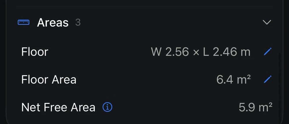
- From the model you can pull room dimensions and floor areas — long after you have left the property.
How accurate is it, really?
In good conditions, iPhone LiDAR captures are usually accurate to within a few centimetres — comfortably good enough for a listing floor area, though the figure varies with the device, the room, its surfaces and how carefully you scan. The honest part matters: good software tells you how accurate a given scan is rather than just handing you a number. FIMIT can even calibrate a scan against a couple of real, tape-verified lengths, so the m² you publish carries evidence behind it. Walk the space once, and the measured interior areas, room sizes and a clean plan are all there — accurate, current, and ready to publish alongside the official figures from the paperwork.
Frequently asked questions
What is the difference between superficie construida and superficie util?
Broadly, superficie construida (built area) includes the walls and often an allocated share of common elements, while superficie util (usable area) is closer to the interior space you can actually occupy; the parcela is the plot itself. The exact definitions vary with the purpose and the applicable regulation — cadastral, valuation and planning rules each treat walls, terraces and common areas differently — so a Spanish listing should be clear about which figure it is quoting and where it came from. Reusing an old figure that no longer matches the reforms is a fast way to lose a buyer's trust.
How do I measure a Spanish property accurately with an iPhone?
Walk the property with a recent iPhone Pro, keeping walls, floors and doorways in view, and the LiDAR scanner records the geometry of each room you cover. Software turns that capture into a 3D model and a to-scale 2D floor plan automatically, so you can pull interior room dimensions and measured floor areas from the model later — without a draughtsman or a return visit with a tape measure. The official constructed or cadastral area is different: it can include walls, terraces and an allocated share of common elements, so it comes from the property's documentation rather than from an interior scan.
How accurate is an iPhone scan for a Spanish listing in m2?
In good conditions an iPhone LiDAR capture is usually accurate to within a few centimetres, comfortably good enough for a listing floor area in square metres — though the exact figure varies with the device, room size, surfaces and how carefully you scan. Good software also tells you how accurate a given scan is rather than just handing you a number, and FIMIT can calibrate a scan against a couple of tape-verified lengths, so the m2 you publish carries evidence behind it instead of being copied from an old nota simple.
Why not just use a tape measure for a Spanish property?
A laser or tape gives you one dimension at a time, by hand, on site — and if you missed a room or an alcove, you have to drive back. For an agent measuring many properties across the Costa del Sol, that is hours of re-visits. Loose measurements also do not assemble into a floor plan buyers can read, whereas one iPhone scan captures the geometry of the rooms you walk, so the measured m2 you need is there later.
Sources and further reading
About the author
Salar Kiabi, Founder, FIMIT
Salar Kiabi is the founder of FIMIT, which turns a single iPhone LiDAR walk-through into an accurate, to-scale 2D floor plan and 3D model for property and facility teams. He writes about measurement accuracy, capture technique, and getting a floor area from a phone that you can actually stand behind.
Related reading
- Floor Plans for Costa del Sol Property ListingsMany Costa del Sol buyers start their search from abroad, so a clear floor plan and accurate m² build the trust that turns online interest into real viewings.
- How to Measure Floor Area for a Property Listing (Accurately)Floor area is a number buyers act on. How to measure it accurately and consistently, which standards matter, and how to capture it from an iPhone.
- How to Create a Floor Plan with Your iPhoneWalk any room with an iPhone and get an accurate, to-scale 2D floor plan and 3D model in minutes — no tape measure. Here is how iPhone LiDAR floor plans work.