
What Makes FIMIT Different: A Trusted Spatial Baseline
By Salar Kiabi, Founder, FIMIT · · 6 min read
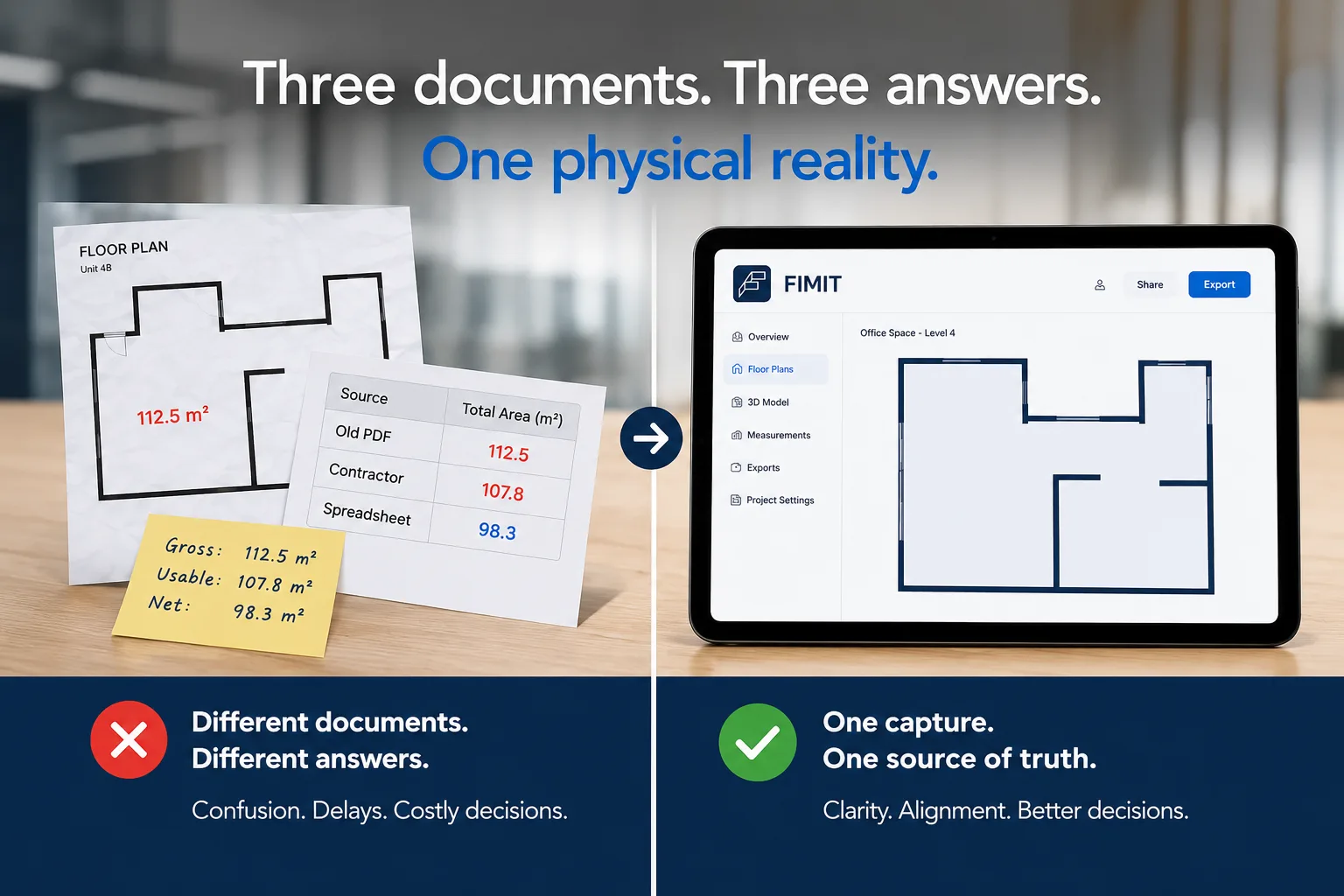
There is no shortage of ways to capture a room today — from photo tours to laser measures to draw-it-yourself apps. FIMIT starts from a specific question: how big is the space, and can you prove it? What it is built to produce is a trusted spatial baseline for the buildings you already have — an accurate record of each space that you can measure, export and stand behind, and that the rest of your property or facility work can plug into. That focus shapes every part of the product. Here is what actually sets it apart.
One walk-through, both the plan and the model
FIMIT captures with the LiDAR scanner built into iPhone Pro models (every Pro from the iPhone 12 Pro onwards — standard iPhones do not carry the sensor) and LiDAR-equipped iPad Pro — no dedicated camera, tripod or return visit. You walk the space once, and the sensor records its real geometry as you go. From that single capture you get two things together:
- A to-scale 2D floor plan you can read and measure at a glance.
- A 3D model of the same space, built from the same captured geometry.
- Floor areas computed from that geometry — not typed in or estimated by hand.
You are never choosing between a plan and a model, or booking a specialist to get one. The phone in your pocket is the capture device, and minutes later you have both — ready to publish on a listing, hand to a contractor, or keep as an always-current record of a building.
Built around the measurement, not the picture
Because floor areas and room dimensions come straight from the captured geometry, the numbers describe the building you actually scanned rather than an inherited or optimistic figure. In many markets the area you publish is information people act on — it drives price comparisons, mortgage decisions and shortlists — so it should be a number you can defend. A picture tells someone what a room looks like; a measured plan tells them, and you, how big it is.
Accuracy you can quantify, not just claim
Here is the part worth being upfront about. Under suitable indoor conditions, an iPhone LiDAR scan produces measurements good enough for many property-documentation and facility-planning tasks. But results vary with the device, the room, its surfaces (mirrors and glass are hard) and how carefully you capture — so important dimensions should be checked before they drive a contract, a build or a safety-critical decision. Every capture tool sits with that reality — FIMIT chooses to say so, and to give you a way to measure it.
FIMIT does something rarer than promising a fixed accuracy: it lets you measure the accuracy of your own scan. With Calibrate-a-Scan you enter a few real-world reference lengths — measurements you have physically verified with a tape or laser — and FIMIT fits a size-weighted correction factor to the scan, returns a confidence score, and flags any reference that looks like a mistake. The correction is additive and fully reversible: the underlying geometry is never altered, a scan can be reverted to raw at any time, and every calibrated export is clearly labelled. It corrects the systematic bias in a capture; it does not erase random sensor noise or fill in what you never scanned. The result is an accuracy figure you can point to, not just assert.
Exports that fit the tools you already use
A capture only pays off if it flows into your workflow. FIMIT scans leave the app in the formats the next person needs — PDF reports on every plan, with the fuller export set on higher tiers:
- PDF, for sharing, sign-off and attaching to a listing — included in every plan.
- A downloadable 3D model (USDZ and GLB), for 3D work and viewers.
- DXF, so a plan opens directly in standard 2D CAD — plus CSV, JSON and GeoJSON data exports on the top tier.
- Surface tags — glass walls, floor types — so the plan carries more than bare outlines.
Organised, EU-hosted, ready for a team
FIMIT is designed for doing this at scale, not just once. Scans, models and plans are organised by building, project and room, so a whole team works from one shared, current record rather than a folder of loose files. And because it is EU-hosted and GDPR-ready, the data lives where European property and facility work expects it to.
What FIMIT does not replace
A trusted baseline is useful precisely because it knows its place. FIMIT gives you accurate, current geometry to plan and work from — it does not replace:
- A certified measured survey, where a regulation, lease or dispute requires one.
- A structural survey or condition inspection — the scan records geometry, not the condition of what it captures.
- Legal property records such as the land registry or cadastre.
- Architectural design work or BIM authoring — exports can feed those tools, not do the designing.
- Safety-critical inspection and certification, which stay with the qualified professionals who carry them out.
Used that way — as the accurate spatial record everything else plugs into — it removes the guesswork those specialists and processes would otherwise inherit.
So — what actually makes FIMIT different?
It comes down to intent. FIMIT is a measurement-first spatial-capture tool: iPhone-native so you can document everything rather than only the flagship spaces, plan-and-model from a single walk-through, honest about accuracy to the point of letting you quantify it, and built to export cleanly and scale across a portfolio. If what you need is a measurable, provable, exportable record of a space — a trusted spatial baseline for the buildings you sell or operate, captured in minutes and hosted in the EU — that is exactly what FIMIT is for.
| What you get | How |
|---|---|
| To-scale 2D floor plan + 3D model | Both from one LiDAR walk-through, in minutes |
| Floor areas & room dimensions | Computed from the captured geometry, not estimated |
| Accuracy you can quantify | Calibrate-a-Scan: reference-based correction, confidence score, reversible |
| CAD & sharing exports | PDF on every plan; USDZ/GLB 3D models and DXF on higher tiers |
| Richer plans | Surface tagging for glass walls and floor types |
| Team-ready & compliant | Organised by building/project/room, EU-hosted, GDPR-ready |
Frequently asked questions
Do I need special hardware to use FIMIT?
No extra kit — but you do need the right phone. FIMIT captures with the LiDAR scanner built into iPhone Pro models (12 Pro onwards) and LiDAR-equipped iPad Pro; standard, non-Pro iPhones do not have the sensor. There is no dedicated camera or tripod to buy. You walk the space with a phone you likely already own, and one walk-through produces both a to-scale 2D floor plan and a 3D model.
How accurate are FIMIT floor plans?
Under suitable indoor conditions an iPhone LiDAR scan is good enough for many property-documentation and facility-planning tasks, but accuracy varies with the device, the room, its surfaces and how carefully you capture. FIMIT lets you measure that rather than guess: Calibrate-a-Scan fits a correction from a few tape-verified reference lengths and returns a confidence score, so you can publish a figure with evidence behind it. Validate critical dimensions before they drive a contract, build or safety decision.
What can I export from FIMIT?
Every plan includes PDF reports for sharing and sign-off. Downloadable 3D models (USDZ and GLB) and DXF export for 2D CAD — plus CSV, JSON and GeoJSON data exports — are included on higher tiers; the pricing page shows exactly what each plan covers. Floor areas are computed from the captured geometry, so the numbers you export match the space you actually scanned.
Where is my data stored?
FIMIT is EU-hosted and GDPR-ready, with scans, models and plans organised by building, project and room so a whole team can work from one shared, current record.
Sources and further reading
About the author
Salar Kiabi, Founder, FIMIT
Salar Kiabi is the founder of FIMIT, which turns a single iPhone LiDAR walk-through into an accurate, to-scale 2D floor plan and 3D model for property and facility teams. He writes about measurement accuracy, capture technique, and getting a floor area from a phone that you can actually stand behind.
Related reading
- How to Create a Floor Plan with Your iPhoneWalk any room with an iPhone and get an accurate, to-scale 2D floor plan and 3D model in minutes — no tape measure. Here is how iPhone LiDAR floor plans work.
- How Accurate Is an iPhone LiDAR Floor Plan? (And How to Trust It)iPhone LiDAR floor plans are usually accurate to a few centimetres, but it varies. What drives accuracy, and how calibration makes it a number you can trust.
- Floor Plans for Real Estate Listings: Why Serious Buyers Expect ThemA floor plan answers the questions photos cannot, so viewings are better qualified. What makes a great one, and how to make it from an iPhone.